M27 and A27 Old Photos
In this gallery I have some old photos of the M27, M275 and A27 I have been sent which I wanted to share with you - so here we go. They are arranged from west-to-east.
Tap each thumbnail to enlarge it.
M27 J4 at Bassett in 1984. Towards the bottom is Rownhams services while the link to the M3 is at the top. The M27 through the junction, and through to Hedge End, was nicknamed the 'missing link' because it wasn't finished until the 1980s. It's under construction here, and the sign in the centre confirms it will be finished.
A close-up of the M27 being finished. It only had three lanes coming up from Rownhams until 2008 (it now has four), but in this photo it has to drop down to two to get past the unfinished part. Space left for the rest of the road is clear. Broken down Blue Line bus couldn't hack it and was on the hard shoulder.
A couple of years later and the new Clock Roundabout is taking shape, with northbound traffic already diverted.
Approaching the Bursledon Roundabout in 1970, from West End Road. The A27 still has green signs at this point as the motorway isn't open.
The sign for the roundabout includes the route of an extension to meet the M27 (Bert Betts Way), badly covered up. On the right is The Lodge, which was later demolished.
Looking back towards West End Road, showing the houses which had to be demolished to build the link road to M27 J8.
A little bit further east at Swanwick, where cable cars are being used to cross the construction site as part of the Bursledon Brickworks Ropeway.
Looking west near Park Gate. The M27 was built with a concrete surface, which is being prepared here. On the left is the West Coastway Line, with a semaphore signal.
Looking east from the same spot. In the distance is the one mile advance sign for J9. From this point the work is more advanced, with the surface laid and the barriers in place.
Looking east from Whiteley Lane. A machine is being used to prepare the concrete carriageway. Space has been cleared for the slip roads up to the never-built Meon services - those slip roads were quickly Tarmaced and painted, despite never being used.
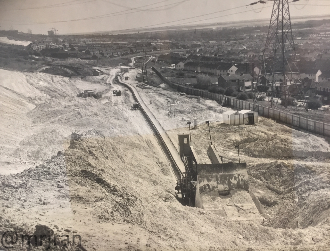
The large conveyor belt which was used to move land dug from the cutting at J11 to the sea at J12. It ran through Paulsgrove, where a gap in the post-war housing had been left for the motorway.
Looking west over J12 in 1975. Here work on the motorway is nearly complete but most of this part of Portsmouth has yet to be built, including both Port Solent and the retail parks along Southampton Road which are still houses here.
The end of the M275 in Portsmouth, in 1987. The park at the top was a beach before the motorway was built.
Looking east on the A27 at the Warblington Interchange on the Havant Bypass, with work starting on the new flyover.
The Warblington Interchange on the A27. On the distant-left is the A27 Havant Bypass, but the road from here to Chichester hadn't been built, so space was left for a flyover. This roundabout has now been changed into two.
Cranes prepare the new road layout at the Warblington Roundabout, as the new A27 is soon to plug in here to the left.
The A27 between Havant and Chichester, watered down from its original proposals, under construction. The concrete surface was finally removed in mid-2000s.
Salthill Road in Fishbourne, looking north at the Clay Lane junction. The A27 to Chichester now runs under the road, being constructed here.